The accuracy of this information can NOT be guaranteed and is NOT intended for the use of protection of life and/or property.
Please tune to your local NWS or EBS station for accurate information.
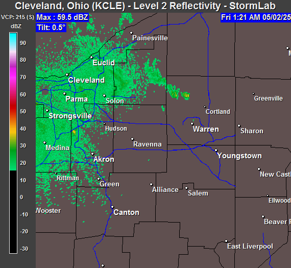
| Radar Image From StormLab
(Updated approx ~5 minutes) |
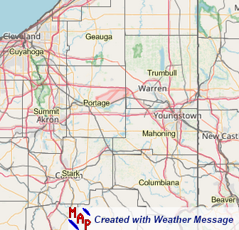
Watch/Warning Map (NWS CLE Office) | |
 |
 |
 |
| Cleveland Radar - Image by StormLab 4.0 | Image by WeatherMessage | |
| (Images & Warnings will update as long as the internet connection from the server does not go down) | ||
Click on the Graphic below for the Storm Prediction Center Outlook (Day 1 & Day 2)
 |
 |
| SPC Day 1 Outlook | SPC Day 2 Outlook |
| NWS Skywarn Publications |
| Weather Spotter Field Guide (PDF 27 MB) |
| Enhanced Fujita Scale (PDF 4 MB) |
| Thunderstorms Lightning & Tornadoes (PDF 14 MB) |
| Lightning Safety (PDF 1 MB) |