The accuracy of this information can NOT be guaranteed and is NOT intended for the use of protection of life and/or property.
Please tune to your local NWS or EBS station for accurate information.
Message from National Weather Service - Cleveland
|
4-1-26 Good morning, Because of ongoing storm survey operations across the region today, we need to postpone the Mahoning County Skywarn class scheduled for this evening. Our staff will be fully involved in survey efforts and unavailable to conduct the training. We understand this may be inconvenient, and we thank you for your patience. Mahoning County EMA and the National Weather Service in Cleveland are coordinating to reschedule the class, and we will announce the new date as soon as it is confirmed. Thank you for your interest in Skywarn and your dedication to severe weather preparedness. We look forward to your attendance at the rescheduled session. Respectfully, Freddie Zeigler NWS Cleveland OH |
2026 Skywarn Training!
Wednesday, April 1, 2026
Postponed
Sign-in Starts: 17:30 (5:30pm)
Training Starts: 18:00 (6:00pm)
Austintown Township Park
Stacey Pavillion
6000 Kirk Road
Austintown, OH 44515
(Ham Radio Net, Training Day: 146.745/R @ 17:00 for info & directions)
| Radar Image From StormLab
(Updated approx ~5 minutes) |
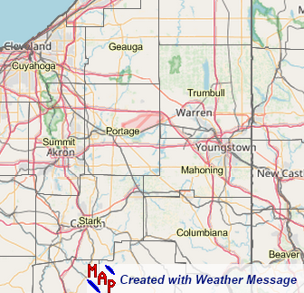
Watch/Warning Map (NWS CLE Office) | |
 |
 |
 |
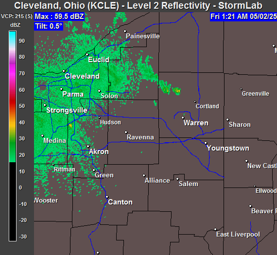
| Cleveland Radar - Image by StormLab 4.0 | Image by WeatherMessage | |
| (Images & Warnings will update as long as the internet connection from the server does not go down) | ||
Click on the Graphic below for the Storm Prediction Center Outlook (Day 1 & Day 2)
 |
 |
| SPC Day 1 Outlook | SPC Day 2 Outlook |
| NWS Skywarn Publications |
| Weather Spotter Field Guide (PDF 27 MB) |
| Enhanced Fujita Scale (PDF 4 MB) |
| Thunderstorms Lightning & Tornadoes (PDF 14 MB) |
| Lightning Safety (PDF 1 MB) |